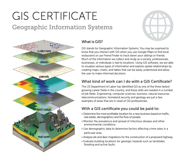
GIS professionals are essential in the process of taking complex information and converting it into clear visual imagery that can be used in a huge variety of career fields. The software used in GIS allows you to visualize, question, analyze, and interpret data in order to understand relationships, patterns, and trends. GIS specialists are responsible for gathering that information, building and maintaining databases, creating sophisticated maps and diagrams, and simplifying complex information so it can be easily understood.
The US Department of Labor has identified GIS as one of the three fastest growing career fields in the country, and these skills are needed in a number of job fields. Engineering, computer sciences, business, natural resources, telecommunications, homeland security and geology are just a few examples of areas that are in need of GIS professionals.
Take as little as 16 weeks or up to a year to complete the 16 credits (6 classes) for the cost of one semester’s tuition and fees (less than $2000). All courses are available online.
| Course | Name |
|---|---|
| GEO 1700 (3 credits) | Fundamentals of GPS and GIS Navigation |
| GEO 1800 (3 credits) | Introduction to Geographic Information Systems |
| GEO 1820 (3 credits) | Intermediate Geographic Information Systems |
| GEO 2845 (1 credit) | Drone Operations and Safety Certification |
| GEO 2850 (3 credits) | Cartography and Digital Mapping |
| GEO 2900 (3 credits) | Applied Geographic Information Systems |
| Total: 16 credits | |